Update on the morning of the 2nd:
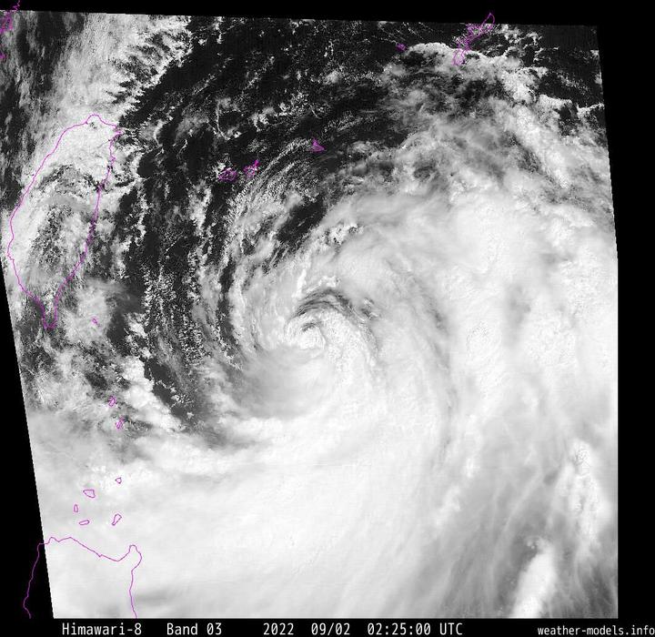
At present, Typhoon Xuan Lannuo, which is attacked by two high pressures and lacks guiding airflow, is stranded in the ocean east of Taiwan. Due to the strong wind shear, the cold water pits dug by itself, and the influence of dry air intrusion, Typhoon Xuan Lannuo is currently far away. Not as good as the previous two days, the intensity has been greatly weakened, and only one typhoon lower limit level is maintained.
However, after staying for two days, due to the strengthening of the East Subtropical High later on the 3rd, it will be guided to start heading north. At present, the conditions in the East China Sea are relatively good for the development of typhoons. Typhoon Xuan Lannuo is very likely to develop into a strong again after heading north. Typhoons or even super typhoons.
Moreover, because Xuan Lannuo unexpectedly moved southeast of Taiwan, and the subtropical high break in the East China Sea was late, the agency adjusted the northward path of Typhoon Xuan Lannuo. Landing on the East China coast, despite its general shape, it may still develop into a super typhoon in the East China Sea, and the East China coast must pay attention.
Update at noon on the 1st:
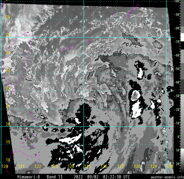
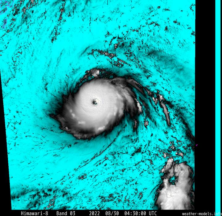
At present, the super typhoon Xuan Lannuo has completed the second eye wall replacement and is gradually moving towards the third peak.
The current BD cloud map shows that there is a WMG+CMG ring in Xuan Lannuo, which is still a level 5 typhoon. In the next two days, it will be affected by the impact of the western subtropical high and the eastern subtropical high, and it will stay near the Ryukyu Islands, and will go north after the west subtropical high No. 3 weakens.
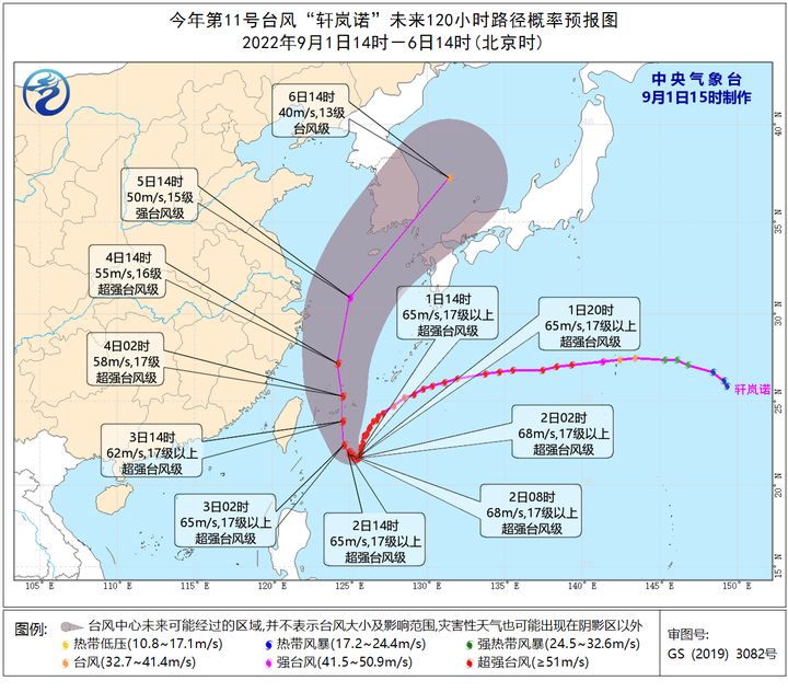
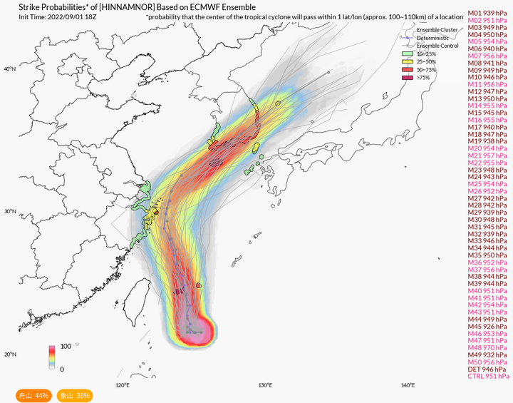
At present, the path error circle only includes Zhoushan. Although it is still impossible to rule out the possibility of Xuan Lannuo landing in Zhejiang, the possibility has been greatly reduced, and the biggest possibility is to attack South Korea or Japan.
Update at noon on the 31st:
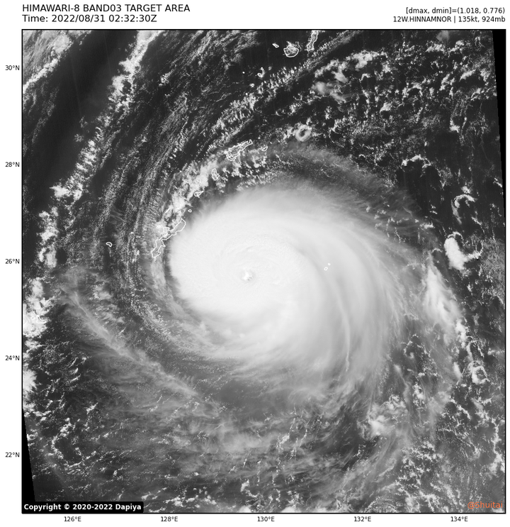
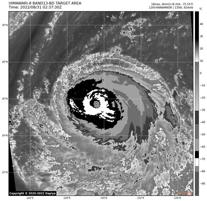
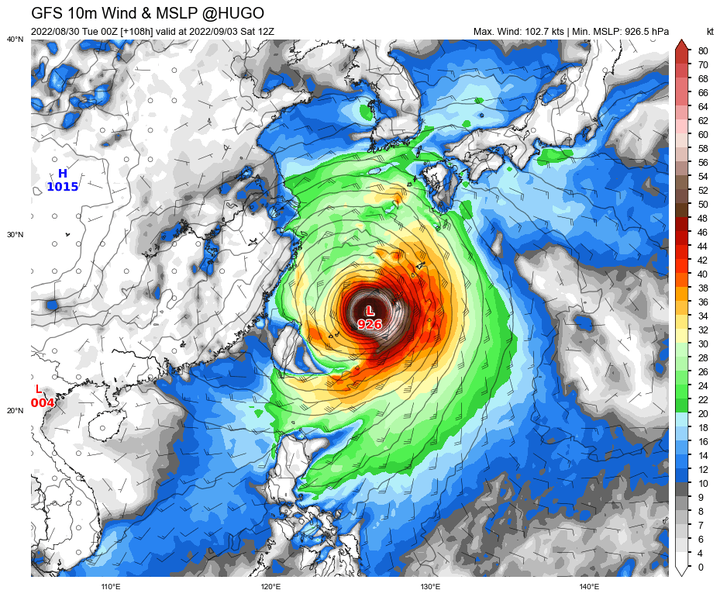
After structural adjustment, Xuan Lannuo is not as strong as yesterday, but it still maintains the level of a Category 5 typhoon. JTWC has already given it an evaluation of 140KT, which has become the first five-level typhoon this year, while the Central Meteorological Observatory still maintains an evaluation of 62m/s (above level 17) and 915hpa.
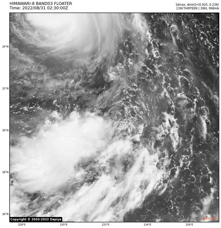
And the 98w in the south of it still lost to the powerful Xuan Lannuo in the end. It was cut into LLCC by the wind and exposed, and was about to be sucked into Xuan Lannuo.
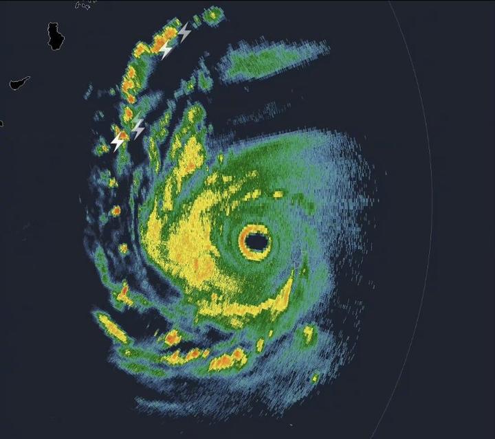
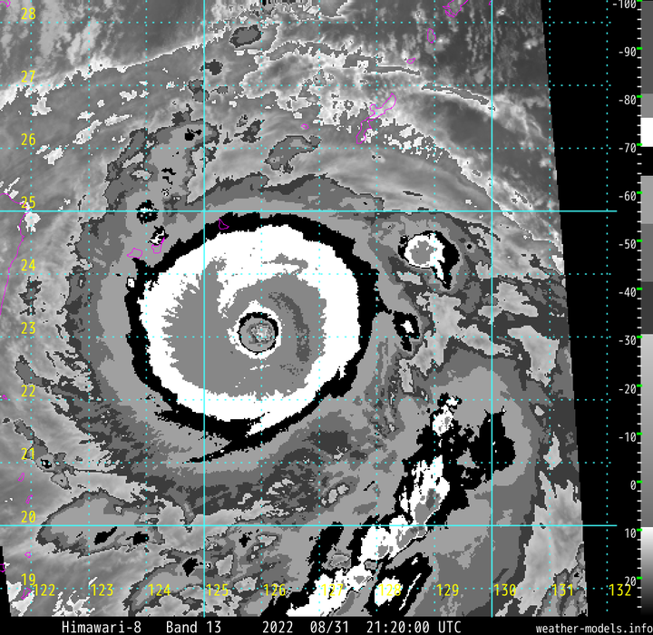
Radar images of Okinawa, Japan show that Xuan Lannuo’s eye wall has a double eye wall again, which means that it may have to start a new round of eye wall replacement.
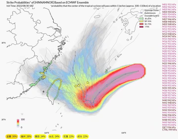
Supercomputer simulations show that it still has several options to enter Fujian, go straight to East China, go north to South Korea, and turn to Japan, but the probability of entering Fujian and going north to South Korea has increased.
Update on the afternoon of the 30th:
Xuan Lannuo is still breaking out, and the bottom layer is very powerful.
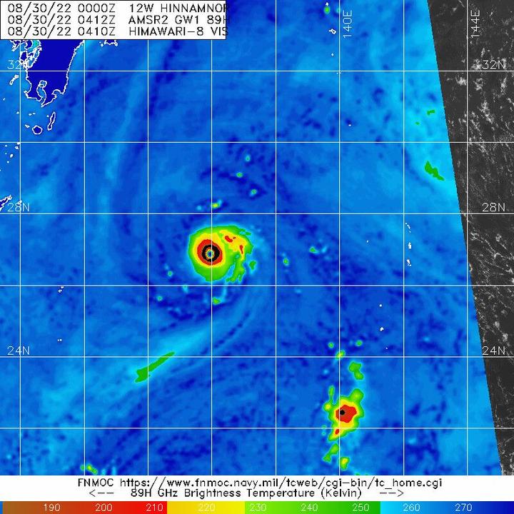
On the afternoon of the 30th, it was possible to self-assess the one-minute average wind speed of 150-155kt, the top typhoon level. The Central Meteorological Observatory gave 62m/s, a 17-level super typhoon.
The following is the original answer on the morning of the 30th:
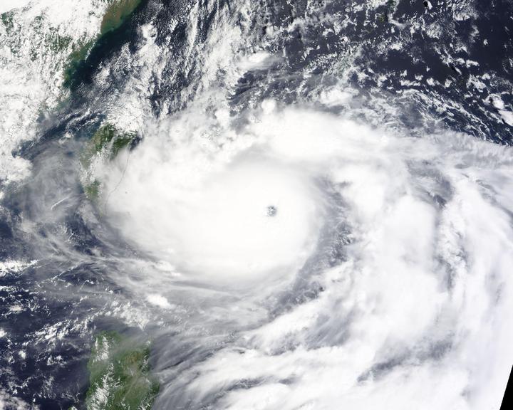
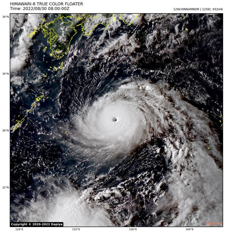
Super Typhoon Hinnamnor (English: Super Typhoon Hinnamnor; International Code: 2211; Joint Typhoon Warning Center: 12W) is the 11th named storm in the 2022 Western Pacific typhoon season. The name “Xuan Lan Nuo” comes from Laos and is replaced by Typhoon Luotan, which means the name of a national protected area in Laos.
A very handsome typhoon.
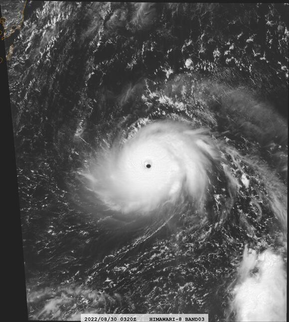
Typhoon Xuan Lannuo has neither the tail of the monsoon nor the hair of the westerly trough. The entire typhoon is its own cloud system, which is very beautiful and very regular. The central dense cloud area has a spiral shape, and the surrounding scattered clouds are very obvious, which shows that its energy is very concentrated, and it is a small and powerful typhoon.
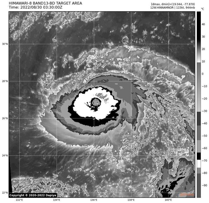
Xuan Lannuo is not only the first super typhoon in the Western Pacific this year, but also the first Category 5 typhoon to come.
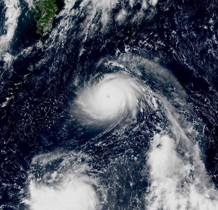
But its path is more difficult to predict, because there are many systems around it and the impact is very large.
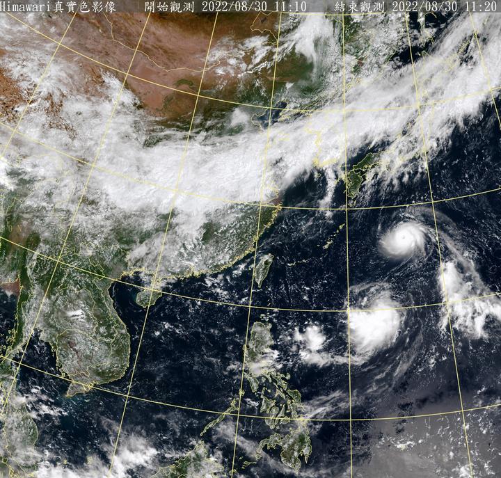
There is a typhoon embryo 98W in the southeast of Typhoon Xuan Lannuo, and we can see that the development of 98W is relatively fast in the satellite cloud image above. It has been upgraded to a tropical depression, and it does not rule out the possibility that 98W will become a typhoon Meihua tonight or tomorrow.
If 98W develops beyond expectations, Xuan Lannuo will have a typhoon Fujiwara effect with it, and the path will be more difficult to predict. If 98W develops in general, or is eaten by Xuan Lannuo, then Xuan Lannuo’s strength prediction will be more difficult. which in turn affects its path prediction. In any case, the appearance of 98w is an obstacle for Xuan Lannuo, because it will bring Xuan Lannuo relatively strong wind shear, and the impact of wind shear on typhoons is fatal. If they get too close, it is bound to be a lose-lose result.
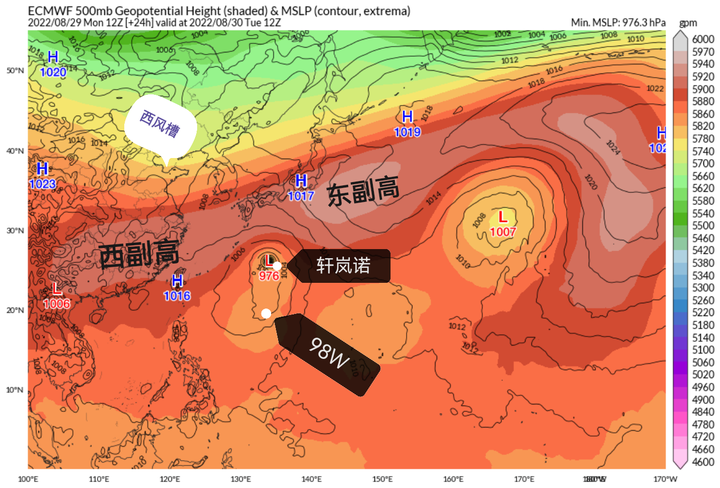
The typhoon path itself is generally guided by the subtropical high and the westerly trough. According to the numerical forecast of the supercomputer, Xuan Lannuo should be affected by the east subtropical high and move to the southwest, gradually approaching the Ryukyu Islands. However, some paths in the Ryukyu Islands have become difficult to predict. First, the western subtropical high will be involved. I don’t know how strong the western subtropical high will be when it arrives. Will it guide it to continue westward, and then the westerly trough will also be in place and start to attract Xuan Lannuo to the north. , and 98w is attracting it to move south or west, and it is also related to the strength of Xuan Lannuo’s development. If it is weak at that time, it may continue to be guided by the subtropical high. If the strength is strong, it may directly open the subtropical high. Go straight to the westerly trough.
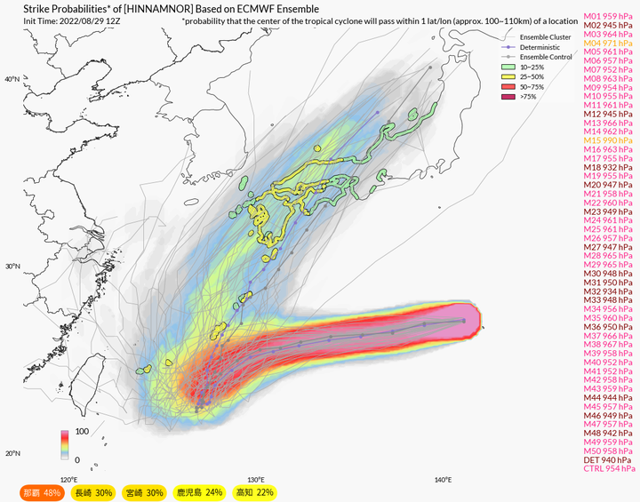
The supercomputer simulated a number of routes, including entering Fujian on the stage, going straight to East China, turning to Korea, turning to Japan and so on.
This shows that the typhoon’s path has become erratic near the Ryukyu Islands.
However, the supercomputer believes that the probability is relatively high or turn around to attack Japan or enter the Sea of Japan from the Tsushima Strait.
The western Pacific Ocean, which has been exposed to sunlight for a long time under the control of the subtropical high, has strong energy. Typhoon Xuan Lannuo can at least secure the position of the global wind king this year, and the Ryukyu Islands cannot avoid a direct attack, and the intensity may be very strong.
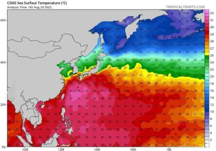
GFS believes that Xuan Lannuo will become a typhoon with a large circulation after entering the East China Sea. First of all, East China will be affected by its sinking airflow, and sunny and hot weather may occur. When Xuan Lannuo gets closer, East China will be affected by its surrounding strong winds. , there will be strong winds, and it will cooperate with the cold air from the westerly trough in the north to bring down the temperature.
Will continue to follow.
Source: Zhihu www.zhihu.com
Author: wait for the wind
[Zhihu Daily] The choice of tens of millions of users, to be a big cow to share new things in the circle of friends.
click to download
There are 67 more answers to this question, see all.
Further reading:
Why are there so many typhoons this year, and they are all strong typhoons, what is the warning?
This article is reproduced from: http://www.zhihu.com/question/550480211/answer/2652033786?utm_campaign=rss&utm_medium=rss&utm_source=rss&utm_content=title
This site is for inclusion only, and the copyright belongs to the original author.