Original link: https://mooncn.win/study/448.html
Geodesy
Geodesy is the discipline of measuring and delineating the Earth’s surface, including the determination of the Earth’s gravitational field and seafloor topography.
Geoid (geoid)
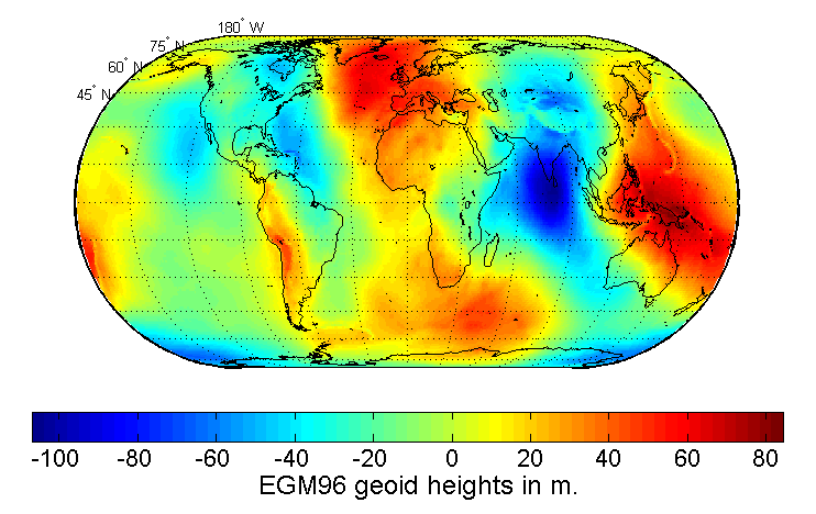
The geoid is the shape of the ocean surface after excluding other influences such as wind and tide, and only considering the influence of gravity and rotation. This shape extends over the land to generate a closed surface. Although we usually say that the earth is a sphere or an ellipsoid, due to the uneven distribution of the earth’s gravity (due to different densities, etc.), the geoid is a…
This article is reprinted from: https://mooncn.win/study/448.html
This site is for inclusion only, and the copyright belongs to the original author.